Blog - For The Record — NYC Department of Records & Information Services

On the Waterfront: A Dip Into New York City’s Most Valued but Least Understood Real Estate

New York City is a seaport. Always has been. Even before Giovanni da Verrazzano sailed into the harbor in 1524 and declared it “a very agreeable place [where] a very wide river, deep at its mouth, flowed out into the sea,”(1) the Lenape had established trading centers along the shore. The City’s shoreline has played a vital role in the regional, national, and global economy. With more miles of shoreline (520!) than the harbors of Boston, Miami, Los Angeles and San Francisco combined,(2) New York’s waterfront has been the site where goods got loaded and unloaded, where a slave market existed, where immigrants arrived by the millions, and where ships got built, fish were landed, people swam, and water to make beer was piped in while sewage was piped out—sometimes in appalling proximity. Our shoreline has been used for many things over the centuries and has expanded significantly through the use of fill.

Documentation of the precise shape and myriad uses of New York City’s waterfront is of interest to scholars, to developers, and to engineers and scientists planning for a resilient city facing the challenges of climate change. Given that our land-water interface has been in constant flux, where can accurate data about it be found? One rich repository of shoreline data is a set of more than 2,000 hand-drawn maps of the waterfronts of all five boroughs, many dating back to surveys conducted in the 1890s. The maps bear annotations indicating that they were updated and actively used well into the 1960s. They were prepared by surveyors and cartographers working for the city’s Department of Docks and its successor agencies,(3) and make up collection REC0133, entitled Waterfront Survey Maps.

Figure 1. Top: the corner of a Waterfront Survey Map showing the extent of damage from age and heavy use.  Bottom: close-up of a waterfront map showing the careful reference to surveyor’s books that provided the data for map preparation.

The collection includes a diverse set of drawings and related materials, but the core materials are hand-inked maps measuring approximately 27” x 40”, drawn to a scale of 1”:50’, with annotations linking them to a collection of surveyor’s notebooks. Many of the maps (which have all been physically conserved) show evidence of heavy use. The maps’ margins have in some cases literally crumbled away—alarming to the archivist, but evidence of the heavy use to which they were put.

The collection has not been analyzed to determine exactly how much of New York’s 500 miles of waterfront is represented.  Some of the most heavily industrialized neighborhoods, such as Newtown Creek on the Queens/Brooklyn border, appear in numerous maps.  An interactive map that locates each map in the collection on a contemporary digital map, as has been done(4) for the Municipal Archives’ collection of 1940s tax photos,(5) would be very helpful (interns, take note!)

To illustrate the extraordinary detail in these maps and their potential value, let’s look at a stretch of waterfront that is perhaps not the first that comes to mind as one of the city’s most active or interesting shorelines: the Hudson River shore on the Upper West Side of Manhattan, starting around 59th Street and extending eight miles uptown to the northern tip of the island.

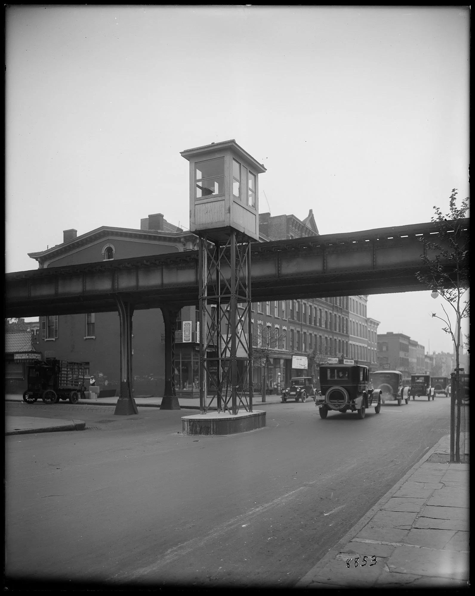
Ever since this stretch was reconfigured by Parks Commissioner Robert Moses in the late 1930s as part of his West Side Improvement Project using 25 million Depression-Era dollars secured from the Roosevelt Administration, as vividly recounted by Robert Caro in The Power Broker, the Upper West Side has worked to regain access to its waterfront.  Moses doesn’t deserve all the blame—the Hudson River Railroad built tracks that hugged the river in 1849,(6) removing access to the water except for a handful of pedestrian bridges and dangerous grade-level crossings. The result was a mashup of industrial and recreational establishments that waxed and waned until Moses imperiously put an end to them all in 1934, reconfiguring Riverside Park, burying the railroad tracks under the park, and constructing the West Side Highway to facilitate access by car and truck to midtown and downtown Manhattan from the outer boroughs and suburbs. The Waterfront Survey Maps collection includes an overlapping series of drawings that span this stretch of Manhattan and reveal a fascinating set of long-forgotten features.

For example, the Hudson River Park and Greenway that now grace the shoreline starting at West 60th Street lie on top of an extraordinary feat of engineering: at least half a dozen piers and dozens of train tracks fanning out from an enormous railroad roundhouse near 72nd Street that distributed train cars arriving from upstate as well as those that were floated across the river from New Jersey and pulled off their barges at the Transfer Bridges whose ruined remains can still be seen in the water off 69th Street. Only vestiges of this industrial complex have been preserved, but the Survey Maps shows it in exquisite detail.

Figure 2. Top left: Waterfront Survey Map wsm_s-255 showing Hudson River from 59th to 74th Streets. Top right: close-up with detail of NY Central Railroad roundhouse. Center: undated photo of 60th Street freight yard showing roundhouse for turning engines, numerous tracks, and the float or transfer bridges bringing freight cars from New Jersey on barges. Lower left: close up of map with transfer bridge detail. Lower right: remnants of transfer bridges in the Hudson today. 

Immediately upriver from the roundhouse was a vast timber basin—a protected stretch of shore with booms that enclosed a kind of harbor where large quantities of wood used in construction were offloaded from ships and kept afloat until needed. Timber basins were familiar sights near shipyards, but Manhattan’s vast consumption of wood for railroad and subway ties as well as in building construction justified a timber basin on the Hudson; the basin at West 75th Street lasted from the mid-1890s until the mid-1920s. The few existing photographs of the timber basin hint at its size and nature; the Waterfront Survey Map for this stretch add details such as the dimensions of its opening to the river, and the advancing shoreline that eventually filled in the basin.

Figure 3. Top: detail from Figure 2 showing timber basin boom and (inset) close-up with dimensions of basin’s opening to the Hudson River. Note penciled annotations for the location of the riverbank at different times. Bottom: rare photo of 75th Street timber basin from Department of Ports and Trade photographs collection, New York City Municipal Archives. 

Starting with the Columbia Yacht Club at 86th Street, the survey map collection documents an astonishing number of boat, canoe, and yacht clubs as well as several swimming clubs—enclosed areas where swimmers could change, lounge, and take dips in the Hudson River while remaining protected from the vagaries of the open river. In the early 20th century, these clubs stretched all the way to Spuyten Duyvil at the northern tip of the island and were particularly dense in Inwood.

Figure 4. Top left: waterfront survey map showing cluster of boat clubs in Fort Washington. Top right: fire insurance map showing much less detail. Lower left: 1924 aerial photo. Lower right: modern satellite photo showing empty shoreline.

At 97th Street, the US Navy maintained a surprisingly robust presence. The survey maps show the outline of the USS Granite State, a remnant of the War of 1812 (!) that served as a training vessel for sailors while docked here from 1910 until she caught fire and burned in 1922. The maps also show onshore Navy facilities that aren’t documented on other contemporary maps.

Figure 5. Top: Waterfront Survey Map showing extensive US Navy structures at West 97th Street with numerous updates in black, red, gold, blue, and green ink. The massive docked ship is the USS Granite State, whose hull outline is marked with a series of red x’s because the ship burned in 1921 (lower photo).

New York City’s biggest celebration ever may have been the Hudson-Fulton Centennial in 1909. A highlight among the many festivities was a naval parade in the Hudson River. The city built an elaborate “watergate” at 110th Street to welcome global dignitaries from the ships anchored in the Hudson. The survey maps document not only the precise location and dimensions of the water gate but also the date of its removal—information that is difficult to locate elsewhere.

Figure 6. The impressive faux-marble water gate built to welcome dignitaries to the Hudson-Fulton Centennial Celebration in September 1909. Top: waterfront survey map detail showing the floating wooden platforms and the footbridge over the NY Central train tracks, all rich with dimensions. The tiny but careful red x’s indicate that the entire structure was removed, as the annotation indicates, on 7 June 1911. Bottom: Municipal Archives photo of the water gate, with a reproduction of Robert Fulton’s Clermont at dock and the newly completed Hendrik Hudson apartment building at West 110th Street in the background.

The detail recorded in the Archives’ waterfront maps is quite extraordinary, as was the careful noting of changes over time, achieved by drawing updates in different color inks. These maps compare favorably to another important historic resource for Manhattan—fire insurance maps. Prepared by private engineers and cartographers rather than a city agency, fire insurance maps are popular with historians for their frequent updates and their building-by-building detail. However, most either stopped their coverage at the closest marginal road to the waterfront or included far less information than the waterfront survey maps do, where their coverage overlapped. The industrialized waterfront in Manhattanville, where West 125th Street extended all the way to the Hudson, provides a final example. This was the location of the Fort Lee Ferry docks. The extensive system of pilings, piers and a ferry terminal are long gone (the terminal building was removed in 1959, for example. How do we know? —map wsm_s-264 tells us so!), but the maps reconstruct this busy strip of waterfront in exquisite detail. Compare the state-of-the-art Bromley fire insurance map of 1934 to the Municipal Archives’ Waterfront Survey Map of the same area. The Archives’ map is incomparably more detailed, right down to the humble lunch stand that can also be seen in a superb photo taken in 1915 by Eugene de Salignac, legendary photographer of the Department of Plant and Structures. (7) 

Figure 7. Manhattanville ferry docks. Top: head-to-head comparison of Waterfront Survey Map and fire insurance map of the same area. Game over. Middleleft: closeup of waterfront map showing palimpsest of numerous superimposed updates. Middleright: Municipal Archives photograph of the Riverside Drive viaduct. Bottom: closeup from photo confirming “Lunch Stand” notation on Waterfront Survey Map.

Nearly all the materials in the Waterfront Survey Map collection have been digitized, and with the completion of a finding aid it is more accessible than ever, to scholars and to anyone with an interest in a detailed understanding of the evolution of New York City’s shoreline.


[1]https://nationalhumanitiescenter.org/pds/amerbegin/contact/text4/verrazzano.pdf

[2]https://www.nyc.gov/assets/planning/download/pdf/plans-studies/comprehensive-waterfront-plan/nyc_comprehensive_waterfront_plan_lo-res.pdf

[3] According to notes made by archivists Amy Stecher and Ian Kern in 2018, the agencies that succeeded the Department of Docks as functions and responsibilities evolved were: Department of Docks and Ferries, 1898-1919; Department of Docks, 1919-1942; Department of Marine and Aviation, 1942-1969; Department of Ports and Terminals, 1968-1985; Department of Ports, International Trade and Commerce, 1985-1986; and Department of Ports and Trade, 1986-1991.  Following the revision of New York City’s charter in 1990, the responsibilities of the Department of Ports and Trade were incorporated into those of the Economic Development Corporation (EDC), which exists today.  Collection REC0133 was accessioned by the New York City Municipal Archives in 1992-1993 from the EDC, which had maintained these records in the Battery Maritime Building.

[4] 1940s.nyc

[5] https://a860-collectionguides.nyc.gov/repositories/2/resources/64

[6] Anonymous. 1851. Hudson River and the Hudson River Railroad, 10-12.

[7]https://www.archives.nyc/blog/2025/3/28/on-the-scene-eugene-de-salignacs-photographs-of-traffic-safety

Good Letters

The New York City Charter explicitly directs that mayoral records must be transferred to the Municipal Archives. Thanks to dedicated librarians and archivists over the past century, the Municipal Archives has become the repository of a significant quantity of records documenting the executive office of City government. The mayoral “collections” in the Archives have served as an essential resource for generations of researchers.  

Letter to Mayor Ed Koch from Jackie Kennedy Onassis, 1983. Mayor Koch Papers, NYC Municipal Archives.

The Mayoral collections date to the mid-nineteenth century. They consist of correspondence between the mayor’s office and municipal agencies and departments as well as state and federal government entities. Beginning in the 1920s and 30s, Rebecca Rankin, Chief Librarian of the Municipal Reference Library, began acquiring and cataloging extant mayoral records she found in City offices. As a member of the Common Council prior to 1834, early mayoral records can found in the papers of the legislative body, also acquired by the Municipal Reference Library. Since establishment of the Municipal Archives in 1952, mayoral records have been transferred directly to the Archives.  

There are a few instances, however, when mayoral correspondence took a more circuitous route to the Municipal Archives. Mayor Edward I. Koch provides an example. Koch served the city as Mayor for three terms, from January 1, 1978, through December 31, 1989. One unusual aspect of the Koch administration is that his clerks and/or assistants transferred records to the Municipal Archives on a rolling basis throughout his term in office. For most other administrations, the mayoral records have been transferred upon conclusion of the term in office.  

The Mayor Koch records date from the pre-digital age. He, and his many deputies and assistants created a lot of paper documents. In terms of quantity, it far surpasses any other mayoral administration, totaling hundreds of cubic feet. 

Mayor Koch returned to private life after his third term ended on December 31, 1989. He became a partner in a law firm, an adjunct professor at New York University, a visiting professor at Brandeis University, and served as a commentator and movie critic on multiple radio and television programs. He died on February 1, 2013, at age 88.  

Letter to Mayor Ed Koch from Norman Mailer, 1986. Mayor Koch Papers, NYC Municipal Archives.

Several months later, the administrators of his estate discovered a trove of correspondence at his residence. The original signed items had been placed in folders labeled “good letters.” They dated from the 1970s through the early 2000s. The administrators intended to sell the collection at auction. The auctioneer selected for the sale divided the correspondence into nine “lots” labeled Political Figures, Entertainment and Literary Figures, Bill Clinton, Vice Presidents, Cardinal Joseph O’Connor, Jacqueline Kennedy Onassis, Ronald Reagan, George Bush, and Jimmy Carter.   

When City archivists learned of the upcoming auction, they contacted the auction house and arranged to examine the items. They discovered that many of the letters were addressed to Koch as Mayor of the City of New York and dated from his term in office.   

Letter to Mayor Ed Koch from Jeane Kirkpatrick, US Ambassador to the United Nations, 1982. Mayor Koch Papers, NYC Municipal Archives.

Which seemed odd. Mayor Koch had been a strong supporter of the Municipal Archives and certainly knew of his obligation to place his records at the institution. He took office shortly after establishment of the Department of Records and Information Services (DORIS) in 1977, and his administration helped build the Archives and the agency. His good friend and political supporter, Eugene Bockman was the first DORIS Commissioner. The conversion of space in the Surrogate’s Court at 31 Chambers Street to accommodate the Municipal Library and the Municipal Archives with climate-controlled storage, conservation, processing and microfilm laboratories all took place during his administration. Staffing in the Archives increased from three people during the fiscal crisis of the mid-seventies, to about two dozen during the Koch years. Mayor Koch also faithfully attended all the exhibits and special events staged by the Department during his tenure.   

In other words, he should have known better. One likely scenario is that he wanted to refer to the letters for his autobiographies. Or, perhaps he thought that copies had been made for the Archives. We’ll never know. When representatives from DORIS contacted the auction house and informed them of the Archives’ charter-mandated responsibility, they agreed to pull the Mayoral-era items from the sale and relinquish them to the Archives.     

Here are several examples of Mayor Koch’s “Good letters.”

Letter to Mayor Ed Koch from John Cardinal O’Connor, Archbishop of New York, 1985. Mayor Koch Papers, NYC Municipal Archives.

Letter to Mayor Ed Koch from Mother Teresa, 1989. Mayor Koch Papers, NYC Municipal Archives.

Letter to Mayor Ed Koch from former President Jimmy Carter, 1984. Mayor Koch Papers, NYC Municipal Archives.

Letter to Mayor Ed Koch from Menachem Begin, Former Prime Minister of Israel, 1985. Mayor Koch Papers, NYC Municipal Archives.

Letter to Mayor Ed Koch from Katherine Hepburn, 1988. Mayor Koch Papers, NYC Municipal Archives.

Landmarks at Sixty

“Try to imagine New York City without Central Park, the Brooklyn Bridge, the Jefferson Market Courthouse, the Flatiron Building, or the brownstones in Stuyvesant Heights, Greenwich Village, Brooklyn Heights and the St. Nicholas Historic Districts.”

Bowne House, Main Street S. and Franklin Place, Queens, 1929. Landmarked 2/15/1966. Borough President Queens collection, NYC Municipal Archives.

These words are printed on a brochure distributed by New York City’s Landmarks Preservation Commission in 1975, ten years after Mayor Robert F. Wagner signed the bill that established the agency on April 19, 1965. 

The story of landmark preservation in New York City neither begins nor ends in 1965, and the collections of the Municipal Library provide the documentation.

The Flatiron Building, ca. 1936. WPA Federal Writers’ Project collection, NYC Municipal Archives. Landmarked 9/20/1966.

Mayor Wagner’s subject files and the records of City Planning Commissioner William F. R. Ballard (1961-1969) in the Municipal Archives are good resources to explore the topic beginning in the early 1960s and leading up to establishment of the Commission in 1965.

One of the earliest documents in Wagner's subject file folder is a copy of his press release dated June 19, 1961, announcing the appointment of a “committee of prominent citizens ...for the purpose of developing a program for the preservation of structures of historic and esthetic importance in the City.”

Six months later, Wagner issued another press release stating that his new Committee had recommended the establishment of a Landmarks Preservation Commission to begin the work of identifying historic structures. Soon after, in February 1962, Wagner requested $50,000 in the budget to fund the new Commission. Receiving approval in early April, he appointed twelve members to the Commission under the leadership of architect Geoffrey Platt.

Mayor Wagner’s Commission could act in only an advisory capacity. It quickly became evident that it would need significantly greater power to protect historic buildings and districts. Using documents in Wagner’s files and the records of City Planning Commissioner Ballard, researchers can explore the ensuing back-and-forth with councilmembers that took place over the next few years as they crafted what would become Local Law 46 of 1965. In essence, the new Law provided that the “Temporary” Landmarks Preservation Commission become a permanent Commission with control over the building exteriors in historic districts.

New York County “Tweed” Courthouse, ca. 1955. NYC Municipal Archives Collection. Landmarked 10/10/1984.

Ballard’s files are notable for the comments solicited and received from interested parties regarding the proposed legislation. His files contain a transcript of City Planning Commission member Harmon Goldstone’s testimony before the Council on December 3, 1964. Goldstone spoke eloquently about the benefits and necessity of the Landmarks law. In his statement, he cited “a quotation attributed to a former Republican President: ‘I like to see a man proud of the place in which he lies. I like to see a man live so that his place will be proud of him.’ —Abraham Lincoln.”  Addressing concerns regarding limitations on private property proposed by the legislation, Goldstone noted: “Just as the zoning power, the police power, the power of eminent domain must take precedence over the interests of the individual, so it is proposed to protect the public interest in our common past.”

Taking up the question of what motived Mayor Wagner to create the Landmark Preservation Committee (and later Commission) in the early 1960s, Ballard’s files provide some clues. Again, Goldstone’s testimony is pertinent: “It was, in fact, at the suggestion of James Felt, then Chairman of the Planning Commission, and with the advice of Maxwell Lehman, Deputy City Administrator, that Mayor Wagner appointed in May 1961, a committee of interested citizens to explore the problem.” The Municipal Archives’ holdings include records created by James Felt during his term as City Planning Commissioner (1956-1963). The inventory does not list an obvious subject in his records, e.g. “Landmarks,” but a closer examination of his correspondence might reveal additional intelligence about what motivated Felt to make the suggestion to Wagner.

Landmarks Preservation Committee brochure, 1988. NYC Municipal Library.

The Municipal Library collection also serves as a resource to answer what prompted Mayor Wagner to create the Commission. Among the Library holdings are several published sources that discuss the historical antecedents of the preservation movement. For example, a report published in 1989 by the Historic City Committee of the Municipal Art Society of New York, entitled “New York, the Historic City,” included a section on the “Background and Development of the New York City Landmark Preservation Commission.” According to the report, “The real flowering of historic preservation in America... came in the decades after World War II as a building boom began to actively threaten historic buildings across the nation.” Not surprisingly, according to the report, growing opposition to Robert Moses played a role: “In Manhattan the modernist glass and steel skyscrapers which had begun to fill midtown, and the white brick apartment buildings interrupting residential rowhouse blocks, coupled with the cumulative effect of thirty years of Robert Moses’ urban renewal work in all boroughs, began to generate citizen interest in the cityscape as it stood.”

Another important impetus, according to the report, came from the Brooklyn Heights Association. In the late 1950s, the Association drafted legislation proposing landmark protection for its historic neighborhood. According to the report, this action made it clear to the city’s political powers that “...historic preservation would be supported by the grass-roots citizenry.”

Alice Austen House, Staten Island, ca. 1940. Landmarked 5/13/69. 1940s Tax Department photographs, NYC Municipal Archives.

Returning to Wagner’s file, two carefully clipped and mounted newspaper articles may also point to a motivation for the legislative action to preserve landmarks. From the New York Times on April 2, 1962, an article announced establishment of the Commission. Tellingly, the story quickly dispensed with the facts of the new Commission in two sentences. It then continued for several paragraphs describing the then-impending demolition of Pennsylvania Station: “Mr. Platt, asked about the architects’ protest over the planned demolition of Penn Station, said he personally regretted that his commission had come into being too late to try to save the terminal.” 

Pennsylvania Station, 1961. Demolished 1964. Mayor Robert F. Wagner papers, NYC Municipal Archives.

The second clipping is an editorial that ran on March 3, 1962, in which the author, Elias S. Wilentz, decried the imminent destruction of the “historic Walt Whitman building as part of its [Housing and Redevelopment Board] plan for Cadman Plaza urban renewal.” The writer noted that the building, “where the great poet helped set the type and print the first edition of “Leaves of Grass” in 1855, marks the central event in Whitman’s life and one of the most historic occasions in our nation’s cultural history.” Like Penn Station, the protests came to naught and the Whitman building vanished.

Further research in Municipal Archives and Library collections will undoubtedly shed light on the origins of the preservation movement and New York City's pioneering agency.

High Bridge, Aqueduct and Pedestrian Walk, Harlem River at West 170th Street, Borough of The Bronx, to High Bridge Park, Borough of Manhattan, ca. 1926. Landmarked 11/10/1970. Municipal Archives Photograph Collection, NYC Municipal Archives.

The Municipal Library collection is also a rich resource for information about the Commission after its establishment in 1965. All landmark designation reports are easily accessible online via the Library’s Government Publications Portal.  Searching the Library catalog pulls up dozens of entries for reports, audits, guides and publications about the Commission and its work. The Library’s vertical files are stuffed with clippings and ephemera charting the trajectory of the often-controversial City agency and its subsequent history – fights over designations, court challenges, etc.

Soon after Mayor Wagner signed the bill in 1965, the Landmarks Preservation Commission got to work. Six months later, the Commission notified the Mayor that a public hearing would be held on October 19, 1965, to consider designation of City Hall, the Municipal Building, New York County [Tweed] Courthouse, Surrogate’s Court (Hall of Records), the Brooklyn Bridge and Fire House, Engine Company 31, at 87 Lafayette Street.

The Surrogates’ Courthouse and the Emigrant Industrial Savings Bank, ca. 1939. Landmarked 2/15/1966. 1940s Tax Department photographs, NYC Municipal Archives.

Jack Lutsky, Wagner’s “Legal Aide” dutifully forwarded the notice to several relevant City offices requesting comments. One response is worth noting. “Dear Mr. Lutsky,” Bradford N. Clark, the Commissioner of the Department of Public Works wrote, “The designation of the Surrogates Court (Hall of Records) is considered appropriate. However, it should be pointed out that the long-range plans for the Manhattan Civic Center contemplate the demolition of this building...”.

Oh. For the Record readers interested in how that played out are welcome to re-read Manhattan’s Civic Center Plan 1964.

DORIS Celebrates Records and Information Management Month

On Wednesday, April 9, 2025, the Records Management Division of the Department of Records and Information Services (DORIS) welcomed colleagues from City agencies to join them at a social event celebrating Records and Information Management Month. More than twenty City agency Record Management Officers (RMOs) enjoyed the get-together that featured project updates, a trivia competition and light snacks.

Readers will be aware that City government’s records in the Municipal Archives and Library form the basis of these weekly blog posts. Have you considered how the records get to those places?  The City’s RMOs are responsible for creating and maintaining lists of the types of records created and received at their offices.  Records can range from the mundane such as invoices to those with historical or cultural significance. The RMOs categorize all of these records and manage their retention, disposal and sometimes transfer to the Archives or Library.  In recent years, RMOs are focusing on managing the growing volume of born digital records that have amassed during the past twenty years.

DORIS Commissioner Pauline Toole greeted the assembled agency RMOs. She announced that sixteen grant applications had been submitted to the New York State Local Government Records Management Improvement Fund (LGRMIF) for a total of $1.1 million in funding. Many were for digitization projects that will permit agencies to dispose of hard copy records upon completion. Commissioner Toole noted that the Department of Transportation had submitted a proposal to fund the disposal of obsolete records housed at the GRM facility in New Jersey. She said the DORIS team would continue to assist agencies with this worthwhile cost-saving measure to identify other records eligible for disposal.

DORIS Record Management Division Director Rose Yndigoyen welcomed the group and led the program. She explained they planned the event to give RMOs the opportunity to meet one another, network, and share ideas. She recognized that RMOs at many agencies often worked solo.

As a way of initiating conversations, ice-breaker questions engaged participants in conversations about the most rewarding part of the job as RMO, the most challenging aspect of the work, and how the role of records management would evolve over the next few years.

She encouraged them to plan similar events at their agencies as a way of educating colleagues about the important work of records management.

Following the “ice-breaker” portion of the program, the hosts conducted a lively trivia competition. For the Record readers are challenged to compare their knowledge to the RMOs:


Answers:

  1. Parks comprise approximately 14% of the land area of New York City;

  2. Bowling Green Park is the City’s oldest public park;

  3. Drag racing teenagers first became a problem in the 1660s;

  4. In 2018, goats running on the track stopped the N train for several hours;

  5. “Hip Hop” was born at a house party in The Bronx;

  6. The Woolworth Building reigned as the world’s tallest building from 1913-1929;

  7. The Brooklyn Bridge opened in 1883;

  8. The “Bad” music video was shot in the Hoyt Schermerhorn subway station;

  9. George Martin’s fantasy world arose from memories of his childhood on Staten Island;

  10. DORIS was established as a city agency in 1977. 

April 1825 - Not Just Murder and Mayhem

Municipal Archives and Library collections are justifiably renowned for their value in documenting the history of New York City. Generations of researchers exploring the events and decisions that shaped the city have been rewarded with rich resources, often in great abundance. Mayoral correspondence, and proceedings and records of the legislative bodies are just two examples of materials that illuminate broad topics in New York City and American urban history. Other collections, such as the Brooklyn Bridge and Central Park drawings, building permits, tax assessments, and the administrative records of Parks, Health, Education, and dozens of other municipal departments all contribute to answering the “how” and “why” questions about City history.  

Sarah Campion, Deposition, 1825. Police Court Collection, NYC Municipal Archives.

Equally important, however, are records that tell us about the people of the city, not just the property-owning classes, political leaders, or its wealthier residents. Census and vital records provide basic facts. But are there records depicting life in New York City one hundred, or even two hundred years ago?    

Yes there are, and of all the collections that illustrate daily life, some of the most useful sources are the several series pertaining to the administration of criminal justice. For many New Yorkers, their interactions with municipal government that took place in a criminal context may be the only evidence of their existence and provide details of their lives not otherwise known.  

Depositions drawn from these judicial records give us a snapshot of the City during the first weeks of April, 1825. 

“Mark Wiley… being examined says he is 19 years of age, has no place to live at present, got out of employment three weeks since, did steal the clothing with the intention to wear [the items] …”  

Conrad Brinkman, Deposition, 1825. Police Court Collection, NYC Municipal Archives.

This deposition is recorded in the complaint of two women who resided at 259 Duane Street. On April 2, 1825, Catharine Carman stated that “Mark Wiley . . . stole one pair pantaloons of the value one dollar and cotton drawers of the value of two dollars.” On the same day, Sarah Campion, also of 259 Duane Street, added her complaint, stating that Mark Wiley stole two pair stockings, one flannel shirt and three cotton shirts.  

The facts of this case can be found in containers labeled simply “Police Court.” The 20 cubic feet in the series date from 1807 to 1830. The Police Court, however, did not come into existence until 1848. Furthermore, many of the documents in the series consist of printed forms that state the defendant, “... may be bound by recognizance to be of good behavior, and keep the peace, and to answer for the above assault, etc. at the next Court of General Sessions of the Peace.” Further research will be necessary, but it is likely that City archivists will refine the collection description to more accurately reflect its provenance.  

Returning to the “Police Court” records from the first days of April 1825, we find Conrad Brinkman’s deposition from April 11, 1825. Mr. Brinkman, of 151 Leonard Street says the house adjoining his residence at 151 Leonard Street, is a disorderly house, kept by Mrs. Parks, “...where black and white men and boys come at all hours of the night cursing and swearing using all kinds of indecent language so as to disturb the peace and good order of society.”   

Perhaps less dramatic, but alive with detail, is the deposition of Daniel H. Carpenter. According to his statement taken on April 4, 1825, Carpenter said that he is “19 years of age, is a shoemaker by trade, has been in the city since November last.” His parents live in Pleasant Valley and he boards at no. 33 Suffolk Street. He admitted that he went into Mr. Edward Windusts’ shop and ate oysters with the spoon that he is charged with stealing. The description of the crime is a little unclear, but it seems that Carpenter pocketed the spoon after finishing the oysters and when he realized he was being pursued he threw the spoon over a fence.  

William Land, Deposition, 1825. Police Court Collection, NYC Municipal Archives.

A description of early labor activism comes from the April 12, 1825, testimony of William Land. According to the 1825 Longworth’s City Directory, Land was a tailor, residing at 43 Dey Street. Land stated Alexander Brown, and several others from the “Society of Tailors” threatened to assault him if he refused to join them “for the purpose of raising the wages of journeymen tailors.”   

Joseph H. Raynor, Deposition, 1825. Police Court Collection, NYC Municipal Archives.

The folder of documents from the first two weeks of April also includes two dozen cases of assault and battery. Joseph H. Raynor, of 47 Arundel Street accused his master, Solomon Fanning of Catherine Street, a cabinet-maker, with beating him without “sufficient” justification. It is likely that Raynor had been apprenticed to Fanning. The case was dismissed.   

Laurence Fitzgerald, Deposition, 1825. Police Court Collection, NYC Municipal Archives.

Several of the assault and battery charges involved husbands and wives. Laurence Fitzgerald of no. 13 Torbert Street, a carpenter, stated that he was “violently assaulted and beaten by Elizabeth Fitzgerald his wife who was in the habit of getting intoxicated and beating him.” Ellen Wilson, a Black, of no. 55 Henry Street deposed that her husband James Wilson knocked her down and kicked her.     

Felix Duponchet, Deposition, 1825. Police Court Collection, NYC Municipal Archives.

And then there is Felix Duponchet. A resident of no. 11 Gold Street, Duponchet swore that on the first day of April 1825, at the Second Ward of the City of New York… he was violently assaulted and beaten by Charles Duval a fencing teacher, at the corner of Greenwich and Courtland Streets without any justification on the part of the said assailant…”   

Jury conviction, John McKeeb, Police Court Collection, NYC Municipal Archives.

Records pertaining to felony prosecutions, e.g. docket books, minutes of court sessions, case file documents, etc. have been described and preserved in the Municipal Archives. Researching the felony prosecution files for the first days of April 1825 reveals several prosecutions for petit larceny, such as the conviction of John McKeeb, a laborer, for stealing “one cheese of the value of two dollars.”  

News article regarding Eliza Hughes from the Evening Post, 1825. Police Court Collection, NYC Municipal Archives.

In another case, Eliza Hughes was indicted for false pretenses. A newspaper article appended to the case file helps clarify Hughes’ scheme and the charges.  

The case file for Unity Gallagher records that she was a “spinster not having the fear of God before her eyes, but moved and seduced by the instigation of the devil,” to murder John Gallagher. She plead ‘not guilty’ on April 7, 1825.  

The many series pertaining to the administration of criminal justice in the Municipal Archives span almost four centuries. They are complex and reflect the ever-changing evolution of the court system. Municipal archivists will continue to evaluate and refine information about the collections.  In the meantime, researchers are invited to explore the collections and may find out about violent “fencing teachers” and nascent labor activists in the garment industry. 

On the Scene: Eugene de Salignac’s Photographs of Traffic Safety

BPS 8214: Williamsburg Bridge, view showing [electric] auto truck, south roadway between Bedford and Driggs Avenue, Brooklyn, June 5, 1923.

Eugene de Salignac served as Photographer for the Department of Plant & Structures (originally the Department of Bridges) from 1906 to 1934. During this time, the agency took on many of the functions that would later be taken over by the Department of Transportation and the MTA. When I wrote New York Rises: Photographs by Eugene de Salignac (Aperture 2007), I included a chapter “Accidents.” In it I wrote: “An important part of de Salignac’s job seems to have been photographing accidents that occurred on or under New York bridges or that involved city-operated bus lines. These were documents made for the City’s Corporation Counsel to use in possible legal cases or to show needed repairs to damaged property. Often de Salignac arrived at the scene within minutes of the incident before passengers had even been evacuated.” What I did not cover in the book were the ways that the Plant & Structures agency tried to address the growing problem of traffic safety. This week’s “For the Record” takes another look at these photos.

BPS 8215: Williamsburg Bridge, view showing [electric] auto truck, south roadway between Bedford and Driggs Avenue, Brooklyn, June 5, 1923.

BPS III 2022: Manhattan Bridge, view showing auto damaged by accident, February 23, 1924.

BPS 5880: Park Circle stage line accident 11:30 a.m., close view, December 6, 1919.

BPS 4974: Lenox Avenue Bridge 145th Street showing accident to auto, Bronx approach north side, July 10, 1917.

BPS 7226: Vernon Avenue Bridge view showing accident to auto truck, May 15, 1922.

BPS IV 1874: Queensboro Bridge, Queens view showing automobile accident, June 11, 1920.

BPS III 1848: Manhattan Bridge view showing auto [taxi] damaged by accident in roadway north side at point 51 looking east from roadway, main span, October 23, 1918.

BPS III 1295: Manhattan Bridge Brooklyn showing accident, J. Ruppert auto truck from subway wall, November 13, 1913. This strange looking vehicle is another electric delivery truck, which were quite common in the City in the early part of the 20th Century.

Nineteenth-century New York was not without traffic accidents. People were struck and killed by horse-drawn carriages and trolley cars with some regularity, and the first recorded automobile accident was on May 30, 1896. However, the early twentieth century saw all manner of new and faster vehicles on the streets of New York, both gas-powered and electric. The introduction of the Model T in 1908 made gas-powered cars ubiquitous and by the nineteen-teens they dominated the roadways. With little in the way of traffic signs or rules of the road, accidents were inevitable. Early cars were not equipped with safety features and accidents were often fatal. In 1913, The New York Times (in an article entitled “Death Harvest”) reported that from 1911 to 1912 the number of people killed from horse-drawn vehicles decreased from 211 to 177, and from streetcars from 148 to 134, but automobile fatalities had risen from 112 to 221. Almost all were pedestrians. In comparison, in January of this year, the Times reported that 2024 had experienced a surge in pedestrian deaths, which had jumped from 101 in 2023 to 119.

BPS IV 2577: Queensboro Bridge showing accident to auto, May 22, 1933.

BPS 7267: 42nd Street and Fifth Avenue view showing Plants & Structures Commissioner Grover Whalen at grand opening for new signal tower for Police Department, June 16, 1922.

BPS 7524: 42nd Street and Fifth Avenue, erecting signal tower, Police Department, December 13, 1922. In the background can be seen the original 1920 signal tower. The new tower is flat on the truck.

BPS 7524: 42nd Street and Fifth Avenue, erecting signal tower, Police Department, December 13, 1922. The new bronze signal tower, designed by Joseph H. Freedlander, being hoisted into place.

BPS 8435: Traffic Tower 42nd Street and Fifth Avenue view of tower, October 18, 1923.

BPS 8436: Traffic Tower 42nd Street and Fifth Avenue view of tower “close,” October 18, 1923.

The first electric traffic lights came about in the nineteen teens, but New York City did not get one until 1920. It was a tall tower with a wooden shed from which a police officer manually controlled the lights. It was installed at Fifth Avenue and 42nd Street, under the oversight of Dr. John F. Harriss, the City’s first traffic commissioner. A typed report from 1953 in the Municipal Library “vertical files” states that “The first traffic towers were in use March 11, 1920, at 34th, 38th, 42nd, 50th and 57th Streets and were painted white with black trim. These towers were replaced by more elaborate ones provided by the Fifth Avenue Association in 1922-3.” A police patrolman in each tower manually operated the signals, though in 1926, a system was installed so that one operator could control the signals in all the towers.

In 1924, the City started installing more towers, mostly at busy intersections in Brooklyn. The first independent traffic lights appeared in 1928, marking the end for the system of traffic towers. A 1928 City Record report by the Department of Plant & Structures notes extensive contracts for the installation of lights: 22 on 10th Avenue and Amsterdam Avenue, 17 on 4th Avenue in Brooklyn, 19 in Queens, 14 along 125th Street, and a smattering in the Bronx. Lights were not yet installed on Staten Island. A completely automated system for Manhattan went into operation on March 8, 1929, and on May 7th the demolition of the old towers began.

BPS 8949: Ceremony at opening of traffic towers Grant Square, Brooklyn, June 17, 1924.

BPS 9018: Police traffic light at Broadway and Vesey Street, July 9, 1924.

BPS 9019: [Crowd at opening of] Police traffic light at Broadway and Vesey Street, July 9, 1924.

Although they were short-lived, the traffic towers had been met with much fanfare when they opened. De Salignac seems to have dashed between many on the same night more than once. His photographs of these towers, all similar, but all different, bring to mind the images of water towers and other industrial structures taken by the conceptual German photographers Bernd and Hilla Becher in the 1960s and 1970s. Enjoy.

Above: Traffic towers along Bedford Avenue, Brooklyn, May 16, 1924.

Above: Traffic Tower Lights, March 5, 1926. Location unknown.

BPS 10053: Traffic tower lights, March 5, 1926.

Above, left and center: Manhattan Bridge showing signal tower, January 15, 1924.

Right: Manhattan Bridge, view showing signal tower Manhattan end of new roadway where auto collided, February 23, 1924.

BPS 11860: Traffic lights, Ocean Avenue and Caton Avenue, August 4, 1928.

BPS 11741: Traffic light and post damaged at 34th Street and Lexington Avenue, May 17, 1928.


All photographs above by Eugene de Salignac, Department of Bridges/Plant & Structures Collection, NYC Municipal Archives.

Sources:

In 2014, Christopher Gray (a cherished and missed friend of this agency) wrote about the history of New York’s Traffic lights in his popular New York Times “Streetscapes” column:

https://www.nytimes.com/2014/05/18/realestate/a-history-of-new-york-traffic-lights.html

https://www.nytimes.com/2025/01/01/nyregion/walkable-new-york-city-became-deadlier-for-pedestrians-in-2024.html

For more on the Bechers: https://spruethmagers.com/artists/bernd-hilla-becher/

Powered by Squarespace